exhibition
Natural History
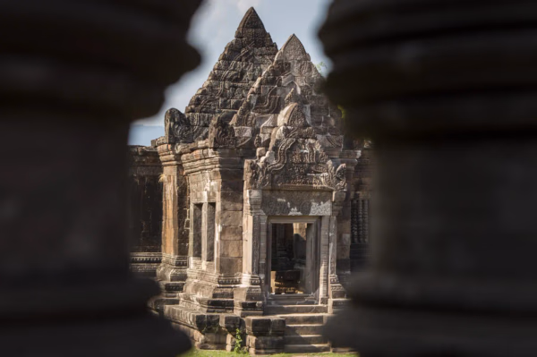
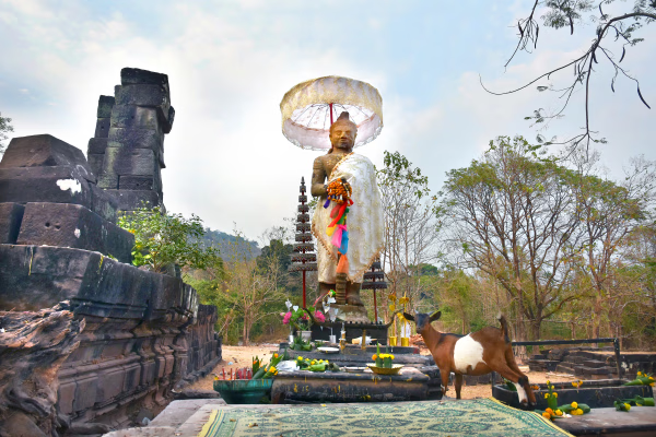
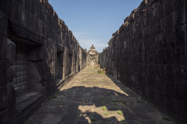
Main Sanctuary
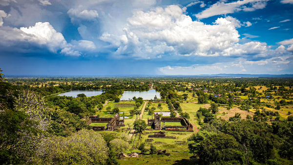
The Vat Phou temple complex consists of a total of six terraces. These terraces are connected by a central walkway and staircases, symbolizing a spiritual journey that gradually ascends from the worldly realm to the realm of the gods.
Natural History
Ancient Road
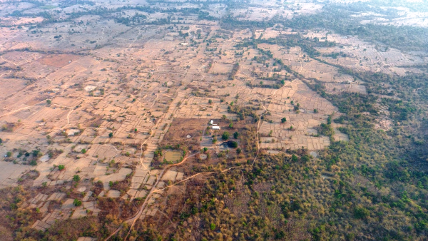
The Khmer Empire, which governed an extensive area, recognized the importance of a well-maintained road network. The Khmer Empire built roads extending in all directions from the capital, Angkor. Most of these roads are now overgrown by tropical forests and grasslands, making their outlines visible only through aerial photography. Along these roads, the Khmer Empire established traveler accommodations and hospitals, with buildings made from sandstone and laterite being discovered.
Natural History
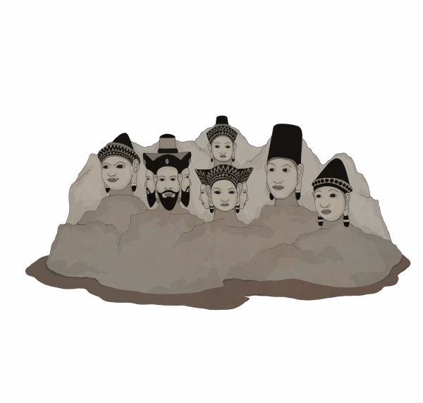
Hinduism in Khmer Society
In Khmer society, Hinduism, particularly Shaivism, was so widely practiced that it almost held the status of a state religion. At the Vat Phou-Champasak site, Shaiva temples, sanctuaries, and hermitages from both the pre- and post-Khmer Empire periods are overwhelmingly abundant. In South India, Shiva is revered as Nataraja, the "Dancer of the Universe" who performs the dance of destruction. In the Kathmandu region of Nepal, known as the land of the Himalayas filled with wild beasts, Shiva is worshiped as Pashupati, the "Lord of Beasts," who holds a special position as a national deity. Among the Khmers, the deity Bhadreshvara was particularly venerated, and the Vat Phou-Champasak site was the origin and most important sacred site of this cult. Many inscriptions found at Vat Phou-Champasak and other Khmer sites convey the exalted status of this unique national deity.
Natural History
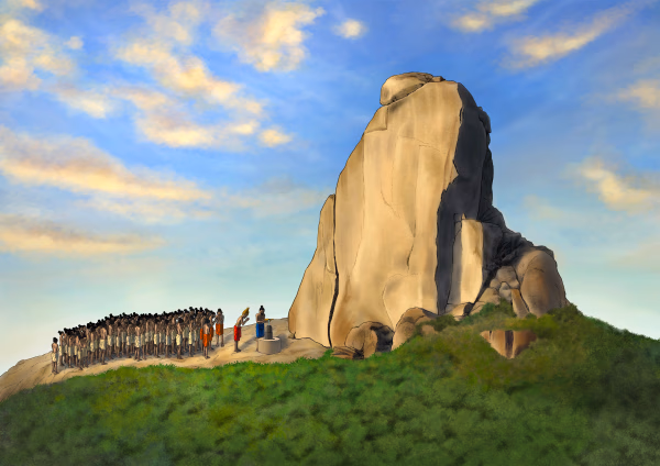
Sacred Mountain - Vat Phou Temple Complex
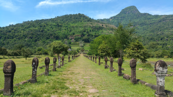
As you reach the end of the path between the barays, you will see the ceremonial bathing embankment of the central baray located to the south. From the center of the embankment to the first terrace of the temple complex, there is a pathway that passes between two smaller barays. This 250-meter-long path is decorated with stone pillars and nagas.
Natural History
Thao Tao Temple and That Sampang Temple
This temple is located 300m east of the Khmer ancient road and about 150 m south from the southern wall of Linga-pura. The temple is surrounded by a laterite wall, which still stands.
Natural History
Natural Landscape of the Vat Phou-Champasak Site
Ancient City Ruins within the Vat Phou-Champasak Site
Natural History
Forest of Hermit
Forest has a significant religious connotation in India. Many sacred forests are often associated with temples, monasteries, shrines, or even burial grounds in Hindu, Buddhist, and other religious traditions. The Hindu tradition considers forests to be of three types (Skt. Tapovan, Mahavan, and Sreevan). Tapovan (or forest of austerities) is a forest (Skt. Vana) associated with penance (Skt. Tapas) by saints and rishis. These sacred forests are believed to be inhabited by Yakshas, Nāgas, and other tutelary deities. They are usually home to sacred rocks, streams, waterfalls, caves, old trees, etc. and serve as repositories for Ayurvedic medicines.
Natural History
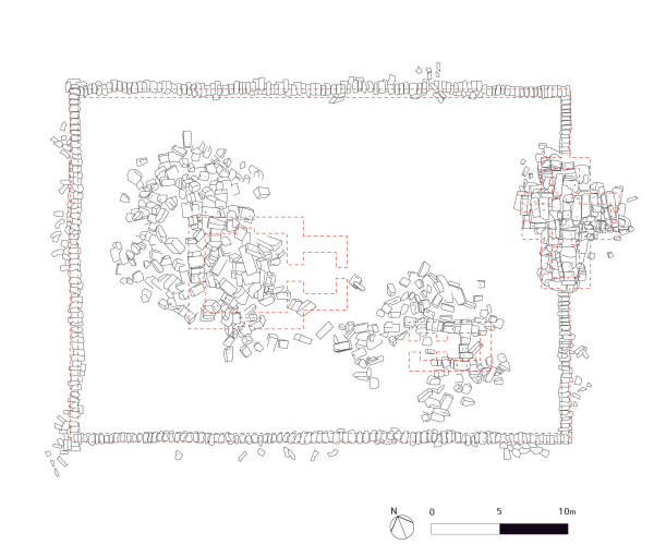
Hong Nang Sida Temple
Research suggests that the temple complex was originally enclosed by a wall with a gopura (gateway tower) serving as the entrance. To the east of the temple, approximately 700 meters away, lies a massive baray (reservoir) measuring about 150 meters by 400 meters.
Natural History
Vat Phou-Champasak Site Exploration Itinerary
The pilgrimage journey from the World of Humans to the World of Saints, the World of Gods, and the World of Emptiness
Natural History
The ancient sanctuary of the Khmer Empire, Vat Phou-Champasak
The official UNESCO designation is "Vat Phou and Associated Ancient Settlements within the Champasak Cultural Landscape."
Natural History
Sacred River
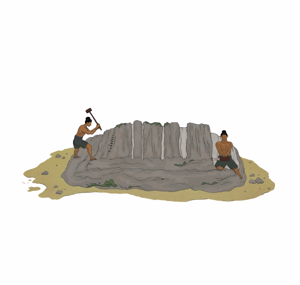
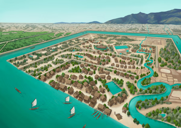
The archaeological site of the ancient city is situated on the plains adjacent to the Mekong River. The city was surrounded by two layers of brick and earthen ramparts, with a moat in between. These ramparts measured approximately 2.4 km from north to south and 1.8 km from east to west, with the best-preserved sections standing up to 6 meters high and 14 meters thick. The walls and moats were likely constructed to manage and utilize the waters from the Phou Kao Mountains' tributaries.
Natural History
All Roads Lead to Rome, The Road to Angkor Wat
The Khmer Empire was known for its vast and intricate network of roads that connected its many cities and sacred sites, much like the saying "All roads lead to Rome" describes the Roman Empire.
Natural History
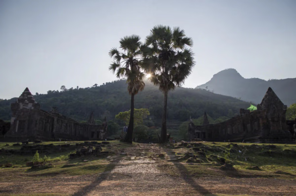
The Sacred Mountain – Lingaparvata (Phou Kao)
Lingaparvata (Phu Kao) seen behind the Vat Phou ruins)
Natural History
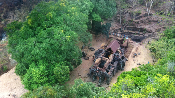
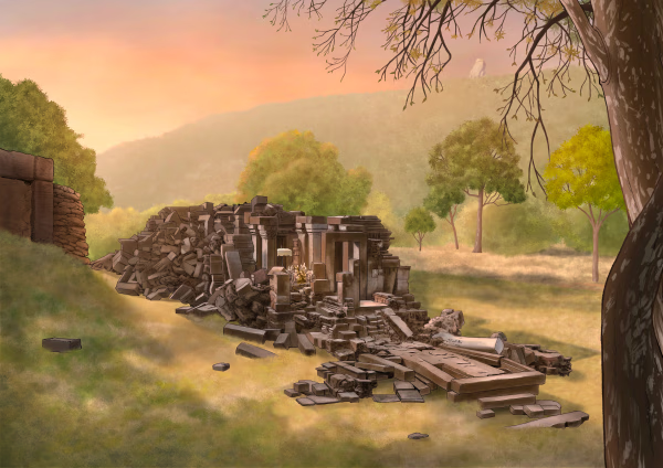
Lao-Korea Cooperation Project : Hong Nang Sida Temple
Since 2013, the Cultural Heritage Administration and the Korea Cultural Heritage Foundation have been working on a heritage restoration project at the World Heritage Site “Vat Phou and Associated Ancient Settlements within the Champasak Cultural Landscape” in Lao PDR. The project focuses on restoring the collapsed stone structure called Hong Nang Sida, located in the southern part of the Vat Phou Temple Complex. This site, also known as the “Temple of Princess Sida,” is gradually regaining its original appearance thanks to the ongoing restoration efforts by a Korean research team.