Forest of Hermit
Oub Moung Temple, Tam Lek Rock-shelter, Phou Pae Waterfall
Published 2024.08.16 by 유다연
ອະທິບາຍ
Forest has a significant religious connotation in India. Many sacred forests are often associated with temples, monasteries, shrines, or even burial grounds in Hindu, Buddhist, and other religious traditions. The Hindu tradition considers forests to be of three types (Skt. Tapovan, Mahavan, and Sreevan). Tapovan (or forest of austerities) is a forest (Skt. Vana) associated with penance (Skt. Tapas) by saints and rishis. These sacred forests are believed to be inhabited by Yakshas, Nāgas, and other tutelary deities. They are usually home to sacred rocks, streams, waterfalls, caves, old trees, etc. and serve as repositories for Ayurvedic medicines.
In Khmer, Shiva was often depicted as a benevolent father with his wife Parvati and two children, Ganesha and Kartikeya. Popular Indian myths or legends of Shiva were rarely expressed in the Khmer reliefs, as the god was mostly depicted in the form of a linga. When expressed in human form, Shiva usually appears as a young ascetic (or rishi), and asceticism in honor of Shiva was particularly favored during the Angkorian period. Shiva's most representative character is an omniscient Yogi who lives an ascetic life on Mt. Kailash. Mt. Lingaparvata is nothing but Mt. Kailash. Thus, the forest of this holy mountain was considered to be the perfect place for hermits to practice austerities, and many Khmer kings respected and supported these hermits. The highest form of Shiva is the formless, limitless, transcendent, unchanging, and absolute Dharma (or the Law of the Universe) and Atman (or the Universal Self), and the linga symbolizes this aspect. Thus, Yoga is the exploration to discover the formless truth. Fortunately, ancient Yogis have left hidden traces in the deep forest. Let us explore the jungle of real Yoga.
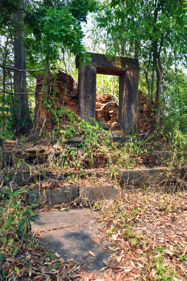
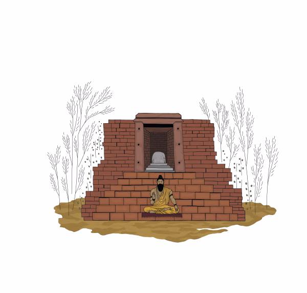
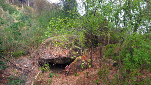
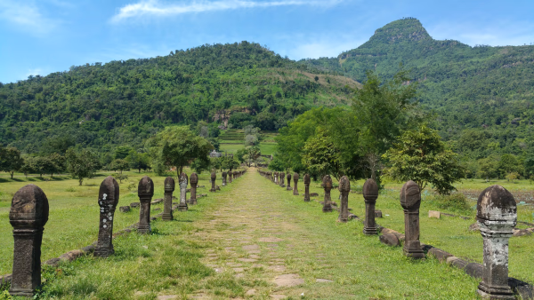
Oub Moung Temple
Oub Moung is located on a small isolated terrace of a mountain about 1.5 km north of the Vat Phou Temple Complex. The ruined forest-shrine dedicated to Shiva consists of a small brick tower with an impressive stone entrance. A Sanskrit inscription engraved on the step of the shrine concerns King Jayavarman II (c. 770–835), known as the founder of the Khmer Empire in 802 at Mt. Mahendraparvata (Mt. Kulen), as well as the builder of its capital Hariharalaya (now Roulos) near Angkor. An inscription (classified K. 235) from Sdok Kak Thom Temple (Thailand), which is a 340-line composition and written in both Sanskrit and ancient Khmer, is carved on a gray sandstone stele 1.51 meters high. It talks about the founding story of an empire, the settling of the people on frontier lands, a king’s grand ritual with Brahmin priests, the royal lineage of 12 kings, and the history and social structure of those times.
"It is clear that many Khmer kings paid respect to the sacred mountains and Hindu priests/hermits. The inscription found here in the isolated forest shrine of Oub Moung is a valuable historical record, as it sheds light on the founder of the Khmer Empire, King Jayavarman II, who revered Mt. Lingaparvata in the same way that he honored, and paid obeisance to Hindu hermits for the well-being of Kambujadesa."
This passage emphasizes the importance that Khmer kings, particularly King Jayavarman II, placed on sacred sites and Hindu hermits, as well as their reverence for the mountain Mt. Lingaparvata. The Oub Moung inscription is highlighted as a significant historical record that offers insights into these practices.
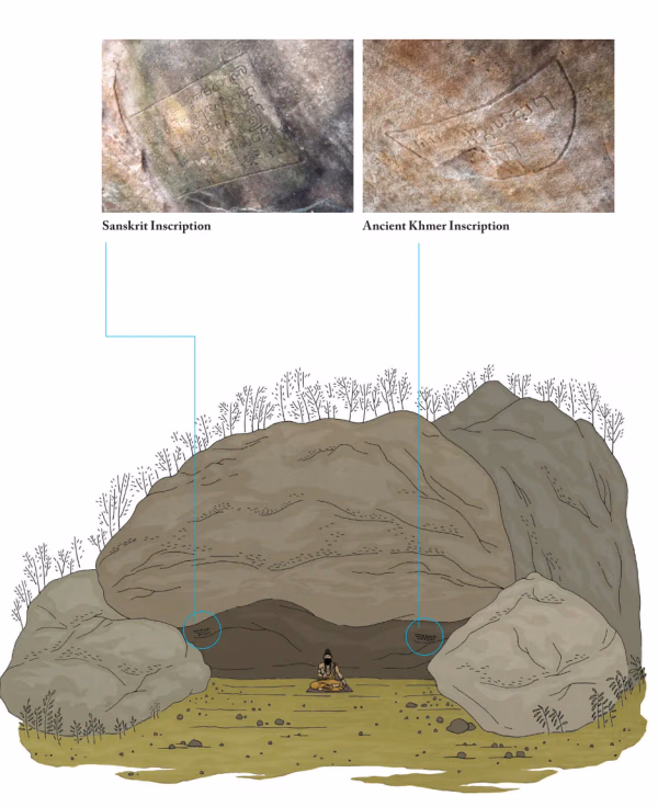
Tham Lek Rock-shelter
The rock-shelter of Tham Lek is located on a terrace of a rocky jungle about 700 m north of the Vat Phou Temple Complex. This small rock-shelter has two inscriptions engraved on the rock surface. These inscriptions reveal the existence of Shaiva asceticism in the deep forest. The two inscriptions are framed by a fine line, and the style of writing is pre-Angkorian (7th to 8th century AD). The first inscription (K 723) is composed of four Sanskrit lines, and it reports the name of the rock-shelter (Vaktra-guha), the name of the ascetic (Vaktra-shiva), and the name of the main deity, Bhadresvara (an epithet of Shiva). The second inscription (K 724), framed by a semi-circular line, is composed of one Khmer line and declares that “it is forbidden to use the cave as a place of habitation.”
There are some traces of other rituals and rock carvings near the rock-shelter. In the middle of the terrace are the remains of a quadrangular structure in the form of a stepped platform of three tiers. Near the structure, there is a linga and a rishi (ascetic) carved on a stone. Many other rock carvings are scattered all around the area, highlighting the importance of this place.
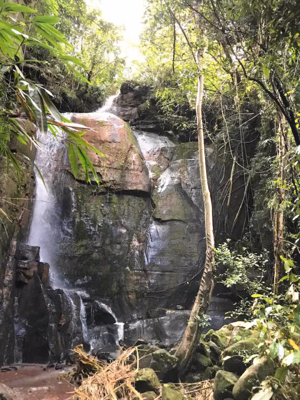
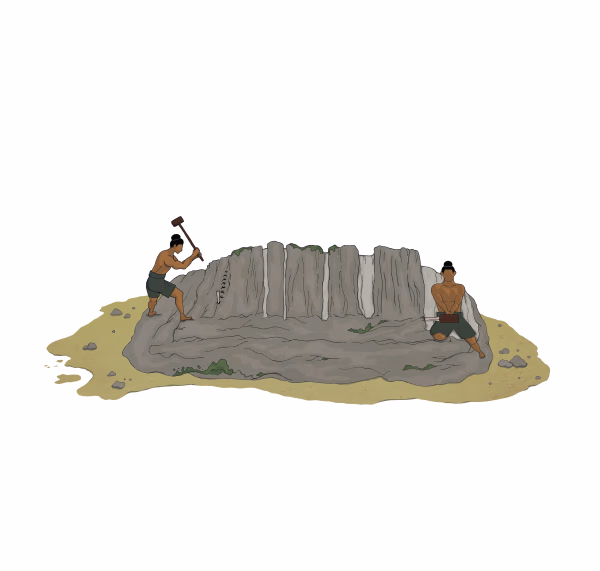
It is reasonable to assume that hermits would have roamed all over the forest. There are very few tangible traces of their spiritual activities, especially austerities. On the cliff face flanking the Phou Pae waterfall, the source for Houay Kok, there is an inscription related to a Khmer king and the commemoration of a religious foundation dedicated to god Vishnu. It is said that Vishnu makes our life as flexible as water and brings energy like seawaves. Thus, Vishnu is often shown amidst water, and the conch in his left hand symbolizes his connection with the power of water.
ບົດທີ
ການນິດສະການທີ່ກ່ຽວຂ້ອງ
Natural History
Online Exhibition of the Vat Phou Champasak Ruins and the Excavation of Hong Nang Sida
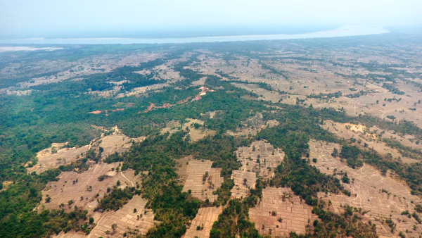
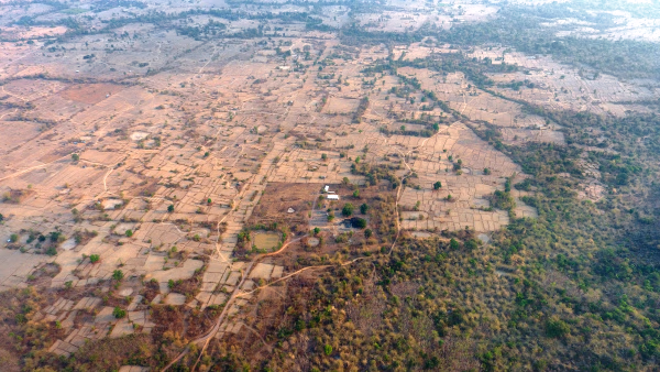
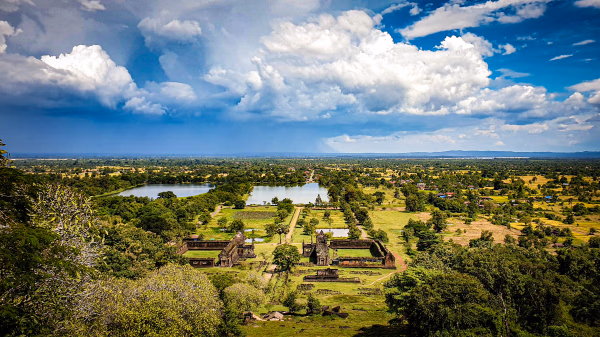
The Vat Phou - Champasak site lies on fertile alluvial plains on the banks of the Mekong River, and its mountainous core is the eastern outlier of the Dângrêk Range, which is home to the Phou Kao Mountains that rise up to an altitude of 1,416 meters.
Natural History
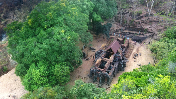
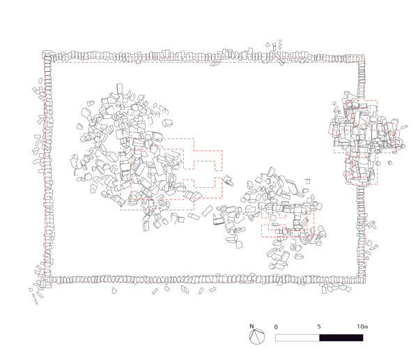
Lao-Korea Cooperation Project : Hong Nang Sida Temple
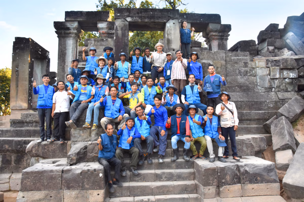
Since 2013, the Cultural Heritage Administration and the Korea Cultural Heritage Foundation have been working on a heritage restoration project at the World Heritage Site “Vat Phou and Associated Ancient Settlements within the Champasak Cultural Landscape” in Lao PDR. The project focuses on restoring the collapsed stone structure called Hong Nang Sida, located in the southern part of the Vat Phou Temple Complex. This site, also known as the “Temple of Princess Sida,” is gradually regaining its original appearance thanks to the ongoing restoration efforts by a Korean research team.
Natural History
Sacred River
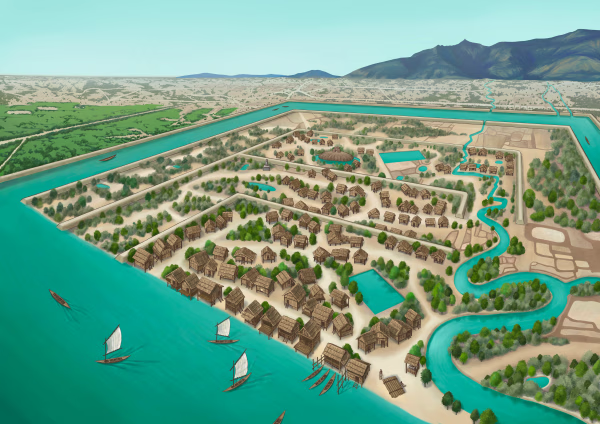
The archaeological site of the ancient city is situated on the plains adjacent to the Mekong River. The city was surrounded by two layers of brick and earthen ramparts, with a moat in between. These ramparts measured approximately 2.4 km from north to south and 1.8 km from east to west, with the best-preserved sections standing up to 6 meters high and 14 meters thick. The walls and moats were likely constructed to manage and utilize the waters from the Phou Kao Mountains' tributaries.