All Roads Lead to Rome, The Road to Angkor Wat
Published 2024.08.14 by 유다연
ອະທິບາຍ
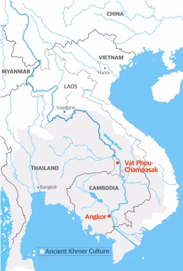
The Khmer Empire was known for its vast and intricate network of roads that connected its many cities and sacred sites, much like the saying "All roads lead to Rome" describes the Roman Empire.
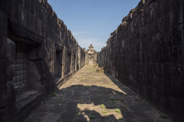
An extensive network of roads led to the capital of Angkor, with one ancient road stretching into Linga-pura, another urban settlement south of the Vat Phou Temple Complex. Along this ancient road, temples were situated a few kilometers apart, functioning primarily as rural shrines while also serving as resthouses and hospitals for pilgrims (e.g., Hong Nang Sida, Thao Tao, and That Sampang).
The archaeological remains from the periods before and after the Khmer Empire
There are many Khmer ruins centered around Cambodia and neighboring countries such as Thailand, Vietnam, and Laos. Without a doubt, the most impressive architectural monuments, artistic sculptures, and urban designs, which boast immense scale and sophistication, can be found in Angkor, the capital of the empire. However, just as a modern nation's capital alone cannot represent the entire nation, the Angkor ruins alone cannot fully depict the vast and dynamic world of the Khmer Empire.
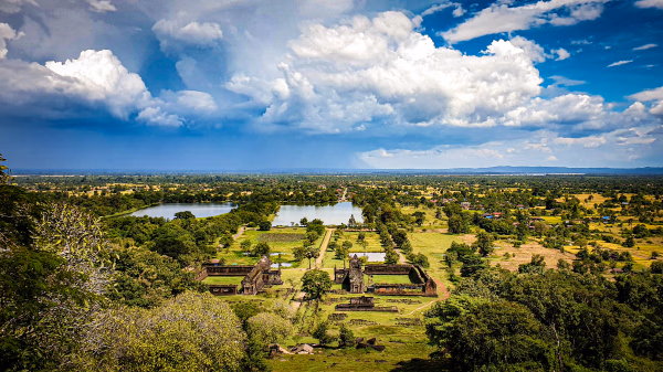
The Vat Phou - Champasak site holds significant potential for restoring a comprehensive understanding of Khmer society. This is because archaeological remains from the periods before and after the Khmer Empire are still well-preserved, thanks to the traditional agricultural practices, housing, and nature-respecting religious culture of the southern Lao PDR (People's Democratic Republic). The cultural landscape, which was formed over a long period and encompasses ancient urban ruins and vast natural scenery, holds crucial potential for shedding light on the relationship between the lives of ancient local people and their environment, beyond just religious and royal culture. It is a rare site where one can indirectly experience various aspects of ancient Khmer life, including ancient temples, archaeological remains that illustrate the relationship between urban and rural areas, traces of secluded practitioners, ancient water management facilities, trade routes with the outside world, and well-preserved sacred natural landscapes. The unique topography of the site also makes it exceptionally rare, as it allows travelers to view the entire cultural landscape of the ancient Khmer from any vantage point.
ການນິດສະການທີ່ກ່ຽວຂ້ອງ
Natural History
Online Exhibition of the Vat Phou Champasak Ruins and the Excavation of Hong Nang Sida
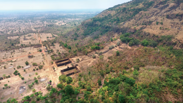
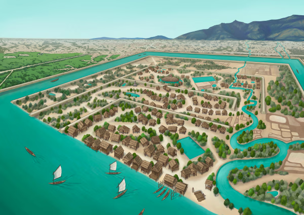
The Vat Phou - Champasak site lies on fertile alluvial plains on the banks of the Mekong River, and its mountainous core is the eastern outlier of the Dângrêk Range, which is home to the Phou Kao Mountains that rise up to an altitude of 1,416 meters.
Natural History
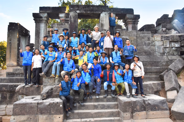
Lao-Korea Cooperation Project : Hong Nang Sida Temple
Since 2013, the Cultural Heritage Administration and the Korea Cultural Heritage Foundation have been working on a heritage restoration project at the World Heritage Site “Vat Phou and Associated Ancient Settlements within the Champasak Cultural Landscape” in Lao PDR. The project focuses on restoring the collapsed stone structure called Hong Nang Sida, located in the southern part of the Vat Phou Temple Complex. This site, also known as the “Temple of Princess Sida,” is gradually regaining its original appearance thanks to the ongoing restoration efforts by a Korean research team.
Natural History
Sacred River
The archaeological site of the ancient city is situated on the plains adjacent to the Mekong River. The city was surrounded by two layers of brick and earthen ramparts, with a moat in between. These ramparts measured approximately 2.4 km from north to south and 1.8 km from east to west, with the best-preserved sections standing up to 6 meters high and 14 meters thick. The walls and moats were likely constructed to manage and utilize the waters from the Phou Kao Mountains' tributaries.