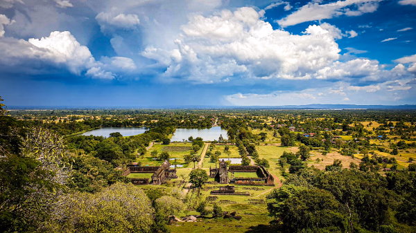
Natural Landscape of the Vat Phou-Champasak Site
Mountains, Forests, Plains, River, and Sunset
Published 2024.08.14 by 유다연
ອະທິບາຍ
Ancient City Ruins within the Vat Phou-Champasak Site
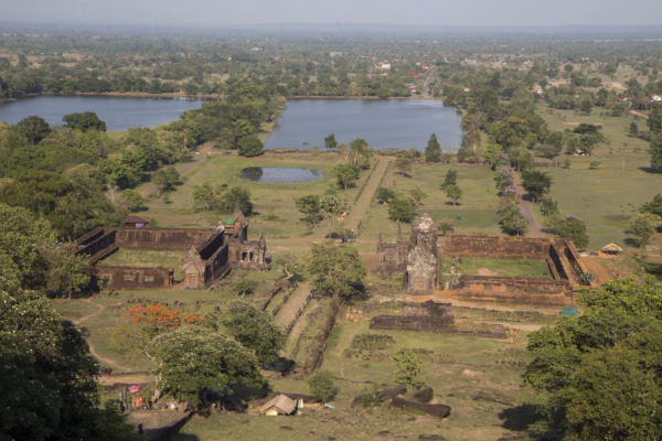
The Vat Phou - Champasak site lies on fertile alluvial plains on the banks of the Mekong River, and its mountainous core is the eastern outlier of the Dângrêk Range, which is home to the Phou Kao Mountains that rise up to an altitude of 1,416 meters.
The area of the Phou Kao Mountains is abundant in continental sandstones of fluvial origin, whereas the area on the eastern banks of the Mekong River is of extensive volcanic origin and consists mainly of basaltic lava and pyroclastic rocks overlaid with extensive lateritic deposits. Both sandstone and laterite were used for constructing the religious architectural structures, as revealed by the significant traces of quarrying activities. Most of the temples on and near the Phou Kao Mountains and on the alluvial plains were built mainly of sandstone, while laterite was used for limited purposes, such as the foundation of a building and walls. However, laterite was extensively utilized for the Tomo Temple Complex, which lies on the eastern banks of the Mekong River.
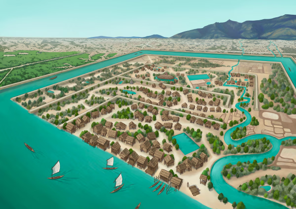
The Mekong River and its numerous tributaries are the main driving force behind the ongoing geological processes at the site. The flow level of the Mekong River is subject to seasonal variations depending on rainfall. During the monsoon season (July to October), the river level rises by up to 10~12 meters, overflowing its natural banks and often flooding the surrounding plains. Many tributaries (or Houay) flowing into the Mekong River illustrate the meandering waterways of the Champasak Plains, and all these tributaries often overflow and cause the flooding of low-lying areas during the monsoon season. The ancient city of Kurukshetra constructed brick/soil walls and moats to control the waterways. Ancient people reorganized waterways and implemented rainwater management through canals and barays for irrigation purposes and daily use. Thus, many hydraulic structures are found scattered across the site.
ການນິດສະການທີ່ກ່ຽວຂ້ອງ
Natural History
Online Exhibition of the Vat Phou Champasak Ruins and the Excavation of Hong Nang Sida
The Vat Phou - Champasak site lies on fertile alluvial plains on the banks of the Mekong River, and its mountainous core is the eastern outlier of the Dângrêk Range, which is home to the Phou Kao Mountains that rise up to an altitude of 1,416 meters.
Natural History
Lao-Korea Cooperation Project : Hong Nang Sida Temple
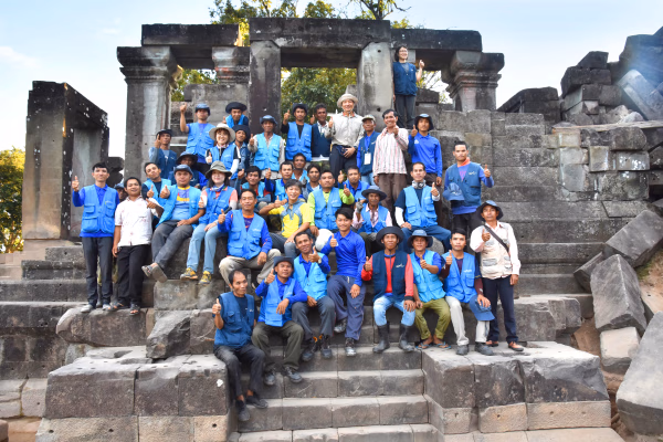
Since 2013, the Cultural Heritage Administration and the Korea Cultural Heritage Foundation have been working on a heritage restoration project at the World Heritage Site “Vat Phou and Associated Ancient Settlements within the Champasak Cultural Landscape” in Lao PDR. The project focuses on restoring the collapsed stone structure called Hong Nang Sida, located in the southern part of the Vat Phou Temple Complex. This site, also known as the “Temple of Princess Sida,” is gradually regaining its original appearance thanks to the ongoing restoration efforts by a Korean research team.
Natural History
Sacred River
The archaeological site of the ancient city is situated on the plains adjacent to the Mekong River. The city was surrounded by two layers of brick and earthen ramparts, with a moat in between. These ramparts measured approximately 2.4 km from north to south and 1.8 km from east to west, with the best-preserved sections standing up to 6 meters high and 14 meters thick. The walls and moats were likely constructed to manage and utilize the waters from the Phou Kao Mountains' tributaries.