Thao Tao Temple and That Sampang Temple
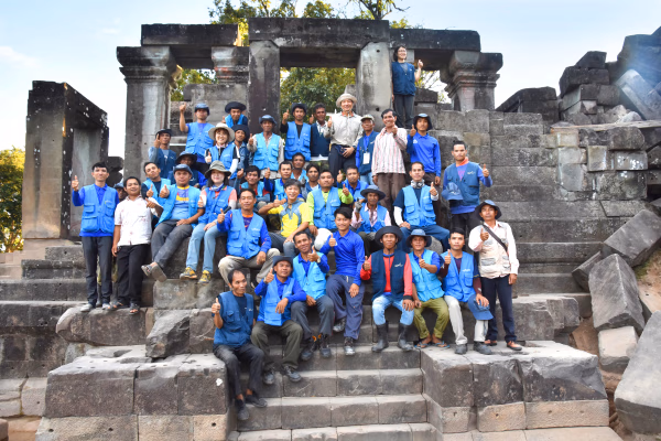
Published 2024.08.16 by 유다연
ອະທິບາຍ
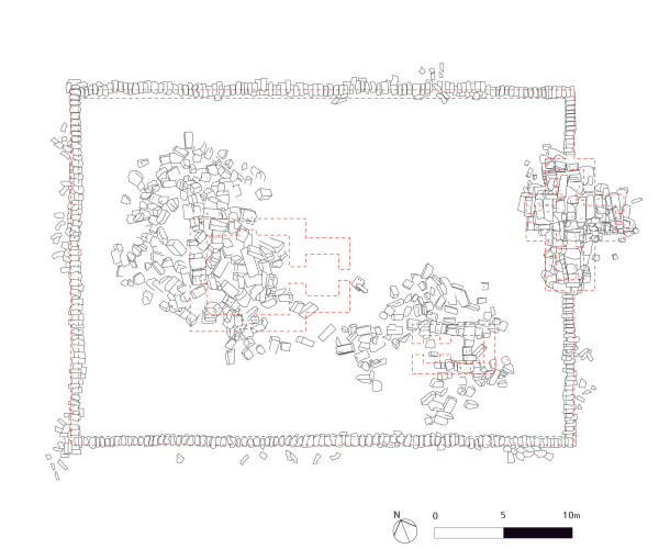
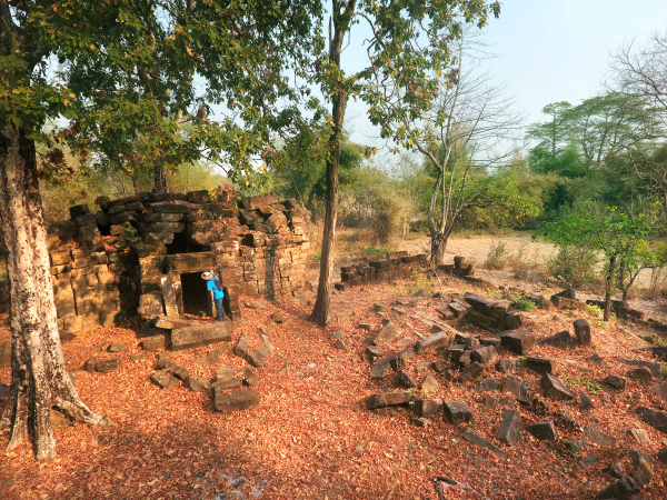
This temple is located 300m east of the Khmer ancient road and about 150 m south from the southern wall of Linga-pura. The temple is surrounded by a laterite wall, which still stands.
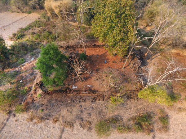
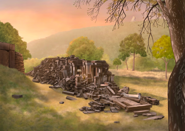
On the east side of the enclosure, there is a gopura built of sandstone. The central shrine was built of large sandstone blocks but has collapsed. A tree has grown inside the collapsed shrine, making it look like a huge plant pot. There is a small ruined building near the central shrine, usually identified as a library. A large baray was built on the eastern side of the temple.
The layout is very similar to the layout of hospitals or rest houses established by King Jayavarman VII in Angkor and elsewhere throughout Khmer territory.
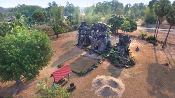
As the name "Three Stupas" suggests, That Sampang Temple features three shrines on a shared platform. Although it is currently used by Buddhists, inscriptions in front of the temple reveal that it originally honored the Hindu trinity: Brahma, Shiva, and Vishnu. The Ban That inscription, named after the surrounding village, contains valuable historical details about a high-ranking Shaivite priest, the grandeur of Mount Lingaparvata, the patronage of Khmer kings, and the fierce battle between King Suryavarman II and his uncle Dharanindravarman I, likened to the mythological Garuda slaying a serpent, highlighting the ruthlessness of politics.
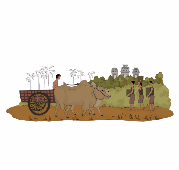
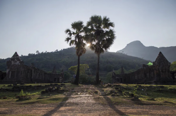
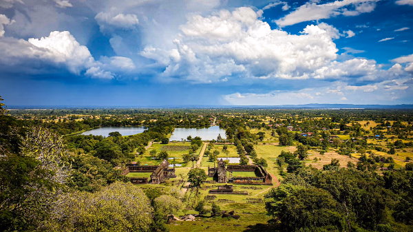
The Vat Phou-Champasak site was predominantly dedicated to the Shaiva sect, yet it was also inclusive of followers of other Hindu deities who visited from various regions. The presence of additional temples alongside the main Shiva sanctuary suggests a respect for other beliefs, reflecting the Khmer society's tolerance toward different Hindu deities and religions. Like other temples, the That Sampang Temple was accompanied by a large baray (reservoir), with the ancient road from Angkor to Vat Phou passing between them. The sunset view over the ancient road and baray is recommended, evoking a sense of the countless merchants, pilgrims, soldiers, and kings who once traveled this path. Today, only the occasional farmer with his ox-cart can be seen, and the reflection of the sunset in the baray adds a melancholic touch. The journey to Angkor, even by modern car, is arduous and takes at least a day, suggesting how challenging it must have been for the ancient travelers. At dusk in the That Sampang Temple, one can almost imagine those travelers offering their prayers after a long and perilous journey.
ບົດທີ
ການນິດສະການທີ່ກ່ຽວຂ້ອງ
Natural History
Online Exhibition of the Vat Phou Champasak Ruins and the Excavation of Hong Nang Sida
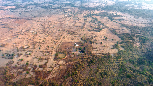
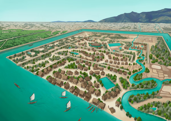
The Vat Phou - Champasak site lies on fertile alluvial plains on the banks of the Mekong River, and its mountainous core is the eastern outlier of the Dângrêk Range, which is home to the Phou Kao Mountains that rise up to an altitude of 1,416 meters.
Natural History
Lao-Korea Cooperation Project : Hong Nang Sida Temple
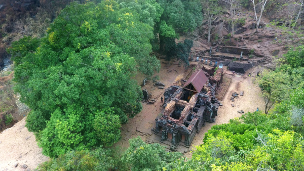
Since 2013, the Cultural Heritage Administration and the Korea Cultural Heritage Foundation have been working on a heritage restoration project at the World Heritage Site “Vat Phou and Associated Ancient Settlements within the Champasak Cultural Landscape” in Lao PDR. The project focuses on restoring the collapsed stone structure called Hong Nang Sida, located in the southern part of the Vat Phou Temple Complex. This site, also known as the “Temple of Princess Sida,” is gradually regaining its original appearance thanks to the ongoing restoration efforts by a Korean research team.
Natural History
Sacred River
The archaeological site of the ancient city is situated on the plains adjacent to the Mekong River. The city was surrounded by two layers of brick and earthen ramparts, with a moat in between. These ramparts measured approximately 2.4 km from north to south and 1.8 km from east to west, with the best-preserved sections standing up to 6 meters high and 14 meters thick. The walls and moats were likely constructed to manage and utilize the waters from the Phou Kao Mountains' tributaries.